After we got back from our wagon adventure, we headed straight for a gas station, since we were pushing empty. Also, the alert that it was time for an oil change had been dinging for a few days, and Alamo’s solution was to offer let us exchange the SUV for something else. Considering the SUV was the perfect size for campgrounds, had a CD players, a rack on top for our luggage carrier, and three rows of seats that folded down, we were not interested in exchanging. So we decided, since we still have like three weeks to go, to just pay for an the oil change ourselves even if it put us behind schedule.
First, we went to the National Historic Trails Interpretive Center. Now, I’ve been keeping an eye on the center for literally months, hoping it would reopen after its COVID closure in time for me to see it. AND IT DID! I was so excited!

Totally worth seeing, it was the most interactive museum we had yet been to. Their typical fifteen minute documentary video was supplemented by lit up figures below the screen, we got to try pulling a fully-loaded Mormon cart, twist a wagon wheel to watch the odometer work, sit in a stagecoach and watch scenery go by as people complained about how crowded they were, play with wooden covered wagons and animals (my wagon got across the river safely, but unfortunately a horse drowned in the process), and try lifting a fully-loaded backpack like those some carried across the country.

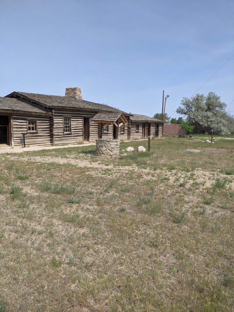
We then had about half an hour to check out Fort Caspar before we had to run to get the oil changed. And we made good use of that time! While this was a modern day reproduction of the fort designed to protect settlers and emigrants, rather than the original, it was still fascinating! Fort Caspar served the emigrants on the trail, was near the river crossing (whether it was the Mormon ferry, or the Reshaw Bridge, both of which were used by emigrants to cross the river), a pony express stop, and a location for the transcontinental telegraph corridor. We loved seeing the replicated buildings, completely furnished, as well as walking on part of the bridge used for emigrants.

Then we hurried out to get the oil on our rental car changed. The car place was very kind and got our SUV through as fast as they could, resulting in us only being like ten minutes behind schedule, whereupon we proceeded to the Bessemer Bend/Red Buttes: This was another crossing – an alternate to the ones you had to pay for at Fort Caspar. It was also another campsite location, and the last opportunity to cross the river. A gorgeous location, right by the river, with lots of greenery! We also ran into a random biker who told us that John Wayne had filmed a movie nearby!
From there, we went to Independence Rock, which was one of my top three stops! I mean, is there anyone who has read a history book that has NOT heard of Independence Rock? This is, of course, an important stop for my fictional family, just as it was for most of the emigrants, marking the almost halfway point to Oregon. “In 1860, Sir Richard Burton calculated that 40,000-50,000 autographs had been placed on the rock in previous decades.” (Traveling the Oregon Trail). We only climbed partway up the rock, because it was pretty steep and we are both still a little nervous after our fall while hiking earlier this year, but we did get to see some signatures!


Devil’s Gate was next. Yet another important landmark for the emigrants, not too far from Independence Rock, this is a huge chasm in the rocks that, while too steep for wagons, nonetheless drew emigrants in as an incredible site. The Mormon Handcart Visitor Center made this sight accessible to the public after they purchased and opened the land. According to their website, “Devil’s Gate marks one of the places where all roads joined into one. Here the California, Oregon, Mormon, and Pony Express Trails converged, creating a single trail corridor where all transcontinental travelers had to pass.” While excited to see it, I didn’t expect the sight to be quite so awe-inspiring. It was truly amazing to see such a huge, random chasm in the rocks!

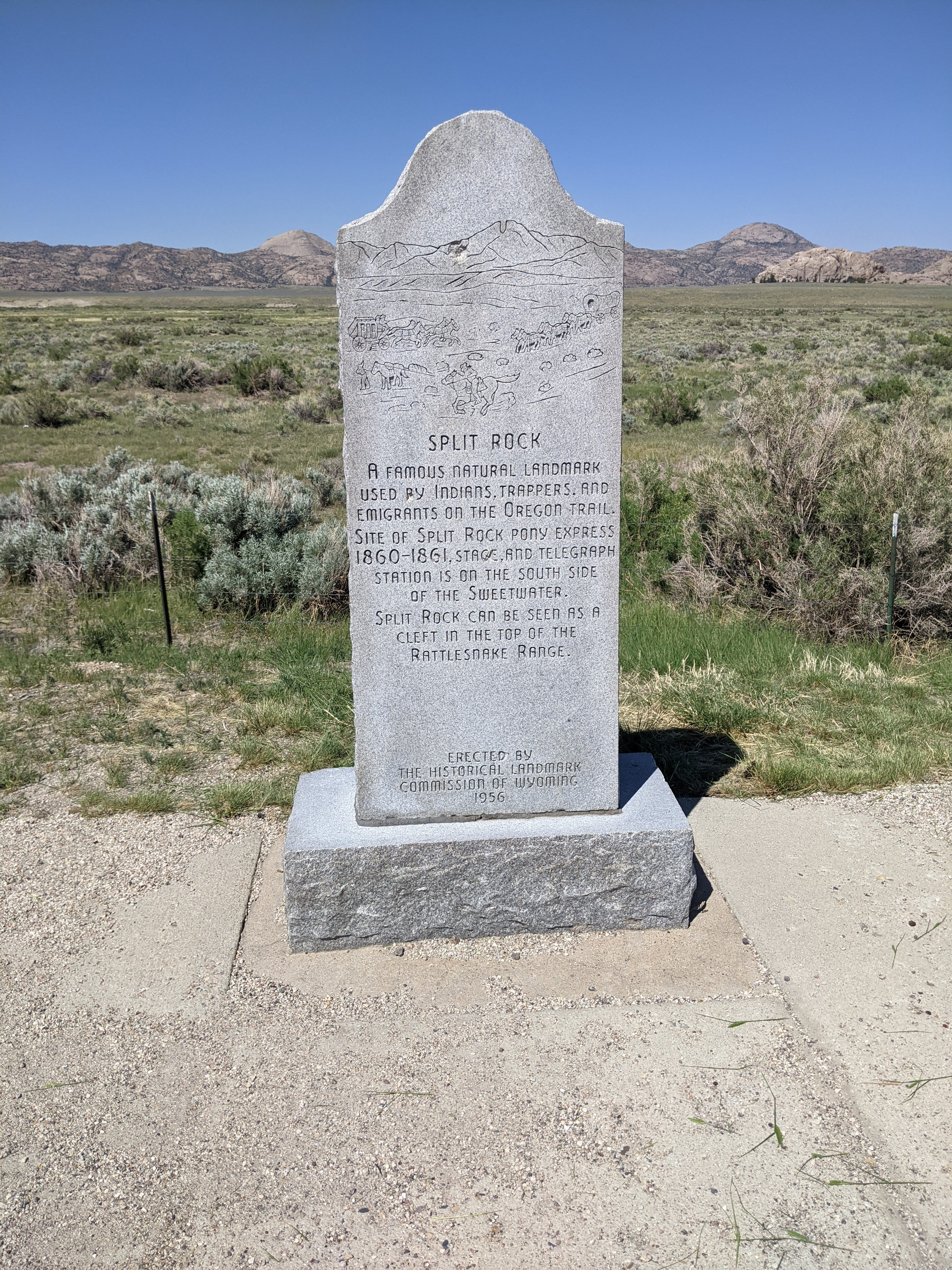
We drove on to Split Rock: According to the Wyoming History site, “Split Rock, with its unforgettable gunsight notch, was visible to emigrants for two days or more as they approached and then left it behind them.” I kind of feel like there was something wrong with me, because I had a hard time telling which of the gaps in the rocks was Split Rock. Maybe I was looking for something too similar to Devil’s Gate? It seemed a little more obvious further away, but I’m still not completely certain I was looking at the right thing. In any case, we got to look at the interpretive site, which brought us to the side of the rock, and then to another monument, place right in front of it.

Saturday, June 24th Traveled 6 miles to Ice Spring or Swamp, where it is said that ice can be had almost at any time, but we could not find any.
http://www.oregonpioneers.com/Condit_Diary.htm
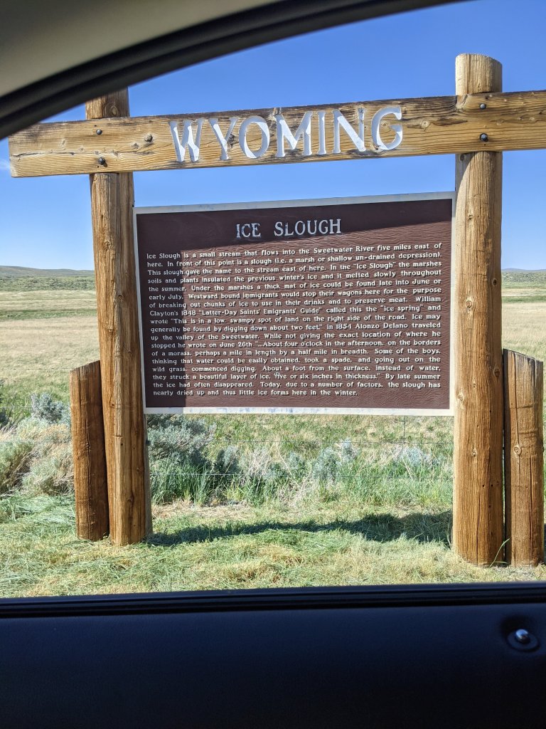
Ice Spring Slough: Emigrants used this location to obtain ice, even in the summer. Following the information on the previously mentioned Wyoming History website, my fictional family refers to it as Ice Springs. “The Ice Slough is actually a small, subsurface tributary that drains into the Sweetwater. A variety of marsh grasses and related tufted marsh plants, known as sedges, form a patchwork of surface plant life. Water flowing underneath this peat-like vegetation freezes solid in the winter and remains frozen during the spring and early summer, thanks to the insulating peat.” Unfortunately, this is no longer the case, according to both Traveling the Oregon Trail and the history website, after long use, the area turned more swampy, without any pure water, and grazing from animals destroyed the peat layer that protected the ice. I put the location into google, and it brought me on this random back road, which I am pretty sure ended up being private property, and kept trying to direct me through random fields…so gave up and went back to the highway, and finally hit a historical marker that said it was five miles east. Since you can’t really find ice anymore anyway, we decided to call that good and move one. 🙂
We swung by Sweetwater Station, another crossing, took a few pictures, and then finally headed to our camping place in Lander, Wyoming!

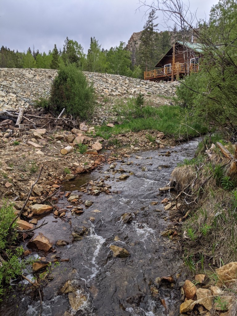
We are at Rock Shop Inn in Lander, Wyoming: Anthony, the proprietor, was kind enough to let us camp on the land even though he isn’t quite ready for tent camping, and it was so worth the stop! The site was just incredible and, if we were not in such a hurry, we would have taken advantage of their beautiful cabins and stayed a couple of days.
Tomorrow, we hit South Pass!
