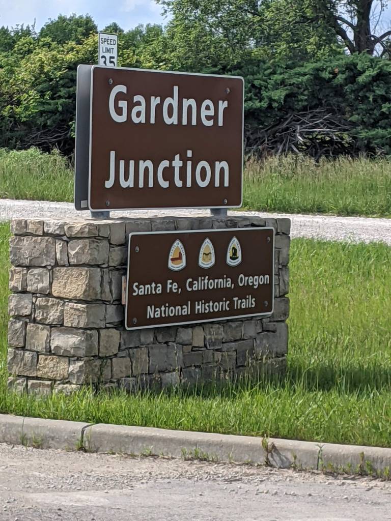
About 40 miles from Independence – so 2-4 days depending on how fast they were traveling – came the first Parting of the Trails (and yes, there was more than one)! While there isn’t much to say about this area, it is still worth noting as the second most significant “stop” when following the trail, since it was at this point that the Oregon/California Trail split from the Santa Fe Trail. The former would head northwest towards the land of opportunity, while the latter wagons headed southwest, often to trade with Mexico, but sometimes to southern locations. If, by the way, you think of Conestoga wagons when thinking of the trail, this is where they came in – it was mostly Conestoga wagons that headed down the Santa Fe Trail because they were great freight wagons for trade and all that. It was mostly prairie schooners that went toward Oregon and California, however, because Conestoga wagons were too heavy to cross the mountains.
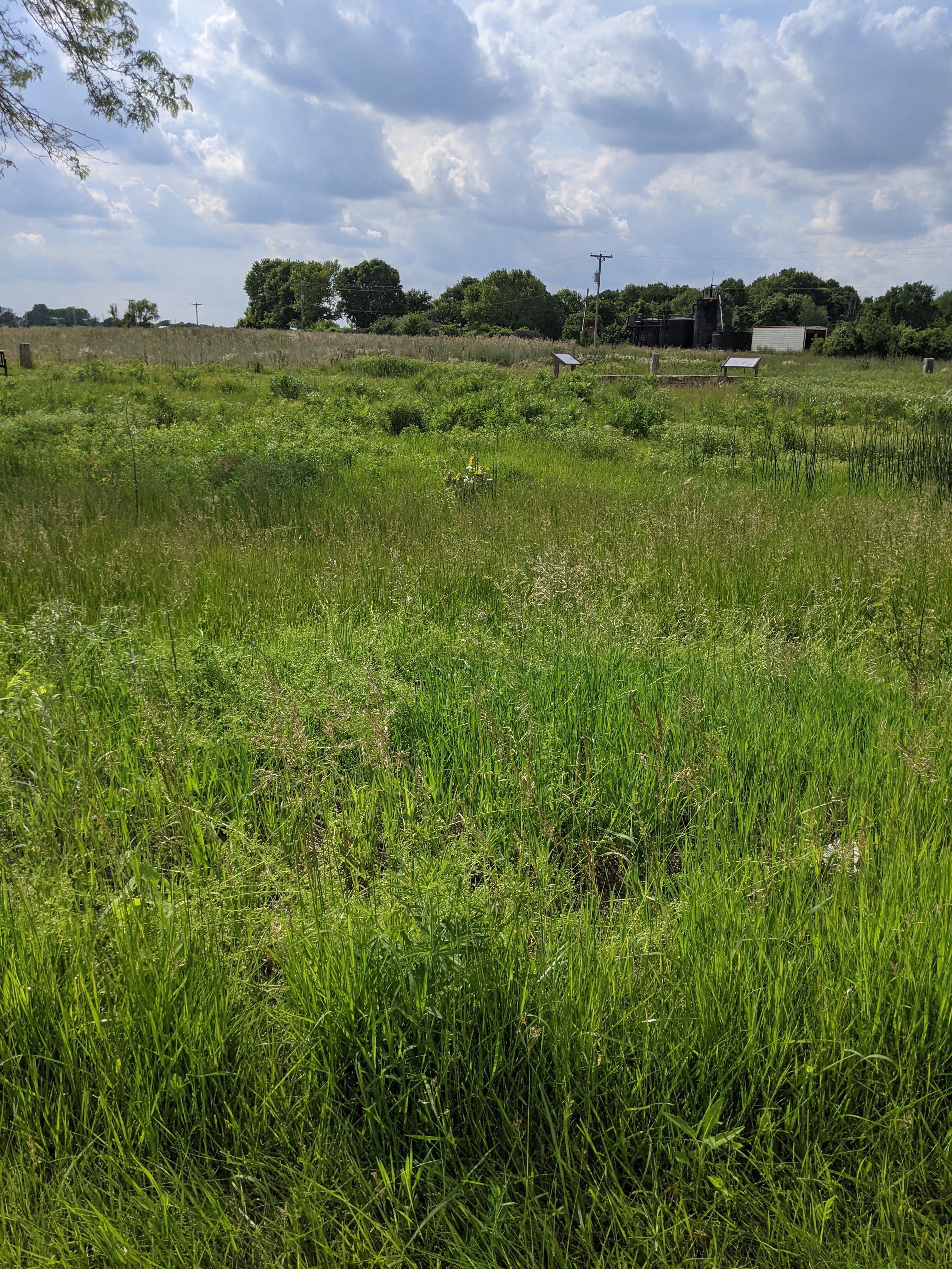
The park currently memorializing the spot is likely a few miles away from where the actual parting of ways took place, but is a beautiful demonstration of what travelers may have seen. The website, Gardner, Kansas says, “Providing a glimpse into the kind of prairie flora westbound travelers would have encountered in the 1800s is the goal of recent plantings at the park…The grasses include: sideoats grama, little bluestem, Indian grass, Canada wild rye, Virginia wild rye, and June grass. Among the wildflowers are: purple prairie clover, black-eyed Susans, several varieties of Kansas gayfeather, bee balm, purple and white coneflowers and butterfly weed.”
Fictional family timeline: April 5th
Samuel Rutherford Dundass, May 1, 1849: “We left today , the great Santa Fe thoroughfare, one of the best natural roads in the world, extending through a vast extent of Prairie, so level that the dashing rains which wash, and keep constantly out of repair, roads in more hilly countries, have no effect on this great highway of nature, but to produce a little mud for a few hours, when the water disappears being absorbed by thee peculiar soil on which it descends.”Santa Fe Trail Association et al., “Santa Fe, Oregon, & California.”, https://www.nps.gov/safe/learn/historyculture/upload/Eye-of-the-Needle-508.pdf
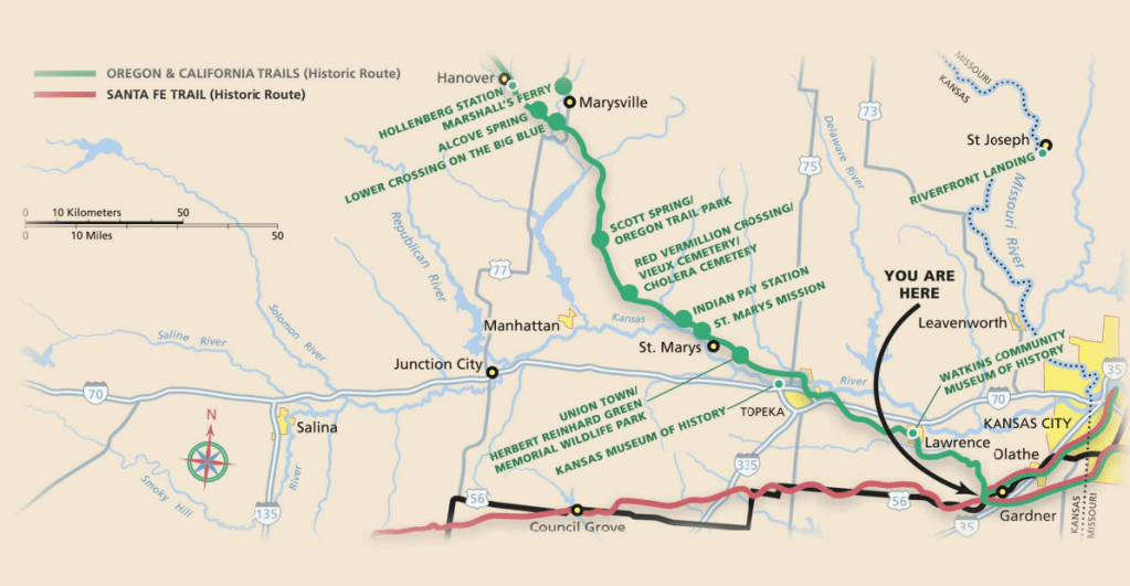
The direction of each trail after splitting at Gardner.
See below for full map, and note the tiny orange line indicating how far we traveled! You can also zoom in for more details (if it works the way it is supposed to anyway…).
Resources:
- Fanselow, Julie. Traveling the Oregon Trail. Falcon Guides, 1997.
- “Gardner Junction Exhibits – Santa Fe National Historic Trail (U.S. National Park Service).” Accessed April 1, 2025. https://www.nps.gov/safe/learn/historyculture/gardner-junction-exhibits.htm.
- “Gardner Junction Park (U.S. National Park Service).” Accessed April 1, 2025. https://www.nps.gov/places/000/gardner-junction-park.htm.
- National Historic Trails Auto Tour Route Interpretive Guide: Western Missouri Through Northeastern Kansas, 2005.
- Oregon and California Trails Association and National Park Service. Oregon and California National Historic Trails. Oregon and California Trails, n.d. https://www.nps.gov/safe/learn/historyculture/upload/Visit-the-Trails-Northwest-508.pdf.
- “Parks | Gardner, KS.” Accessed April 1, 2025. https://www.gardnerkansas.gov/Home/Components/FacilityDirectory/FacilityDirectory/18/143.
- Santa Fe Trail Association, Oregon-California Trails Association, City of Gardner, and National Park Service. “Santa Fe, Oregon, & California,” n.d. https://www.nps.gov/safe/learn/historyculture/upload/Eye-of-the-Needle-508.pdf.
