
Day 16 (June 12): So, my predictions yesterday were not quite as off as I thought they were. We did reach Yellowstone around 4:30 p.m., it is just that our campground was 2 hours into the park! I didn’t know this park was basically like its own state! Did anyone else know this? How did I miss this?

Anyway, we took our time getting to the campground so we could see as much of Yellowstone as possible in our short visit there. We basically drove straight to Old Faithful, since that was high on our priority list, with a couple pull offs to take pictures of what turned out to be elk (not moose, for the record), and the just completely extraordinary scenery! Like, it took our breath away.
Anyway, I was honestly shocked at how much of a production Old Faithful was. I mean I expected there to be a crowd there, but it has its own visitor center, hotel, restaurants, gift stores, it’s like a whole complex. But we got there only a half hour before it was scheduled to erupt, which we were delighted with especially when we saw how much the bleachers in front of it were filling up.
We barely found two seats, and sat next to a family with two children, me squeezing as close as possible to Daniel to avoid the weird gooey gunk on the bench. It was pretty cool though, and there was a lot of camaraderie as Old Faithful decided whether or not it was time to erupt, and we saw a little spurts of bubbles and then it would go back down for another minute, and then come back up, until the final awesome eruption!


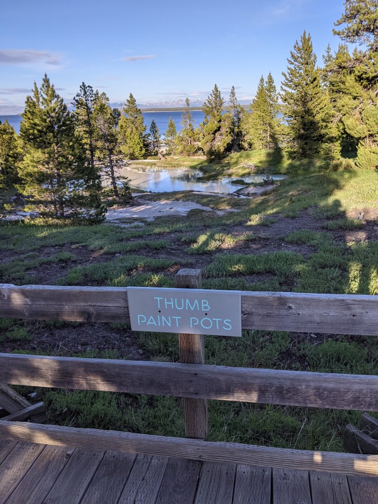
From there, we continued on toward our campsite, pulling over as desired, including to see the paint pots, which as far as I can understand are basically boiling hot mud piles. We couldn’t believe how many geuysers we saw, and yet they never became commonplace. We love seeing the steam rising, and pulling over to take pictures. I think one of my favorites was a spring running through some open field and steam rising from it because it was so hot.
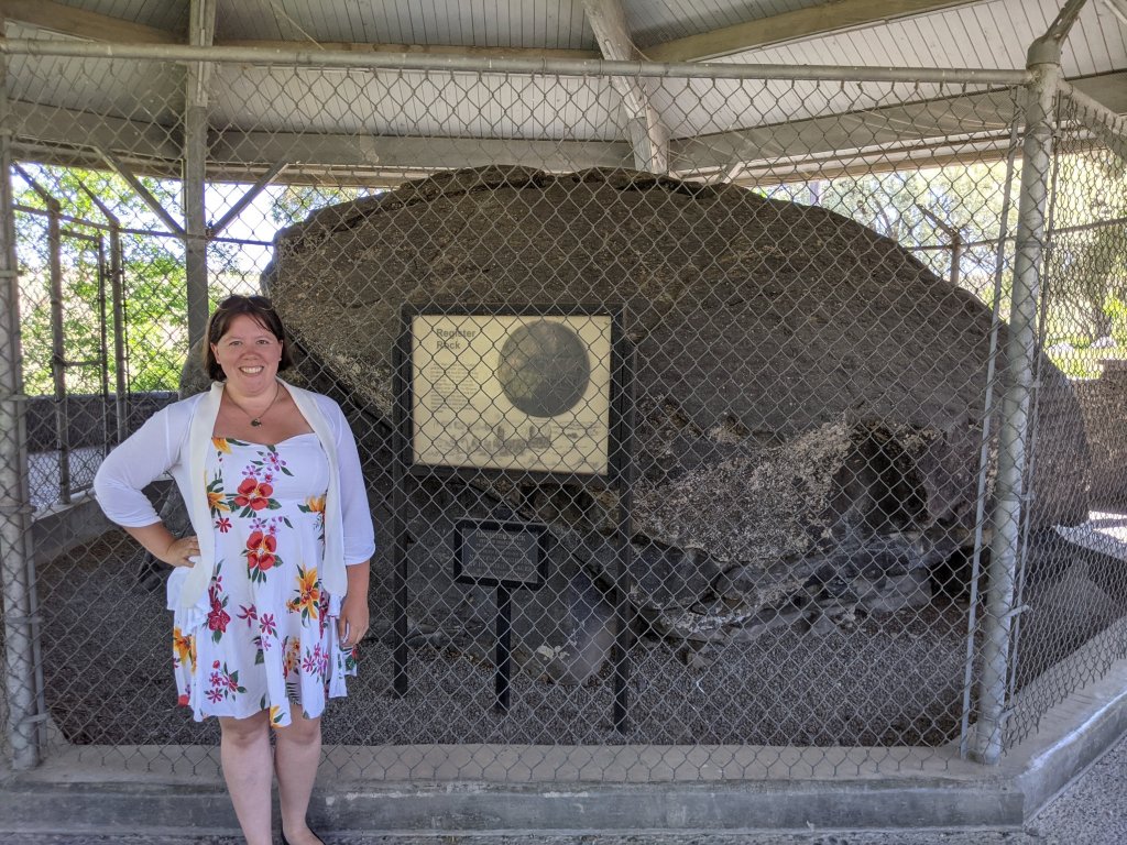
We left at an insanely early hour this morning to pick up the trail where we left off, heading to Massacre Rocks. While this area is named for a fight with Indians in 1862, it is more known for its beautiful hiking trails and the fact that you can see some Oregon Trail ruts here as well! Not too far away is the more famous Register Rock, a popular resting area for emigrants, and another rock on which many names were signed. Thanks to how far inside Yellowstone our campsite was, we were running about 2 hours behind schedule, so we decided to go straight to Register Rock since we weren’t quite sure what we would be looking at in massacre rocks State Park anyway. It was astonishingly small, especially compared to Independence rock, and completely partitioned off, as you can see it, but still super cool to see.
Mon. [July] 5th: Our camp last night was Raft river; here the California Road turns off. The Roads from here to Big Marsh are quite rough & some hilly with no water & but little feed.
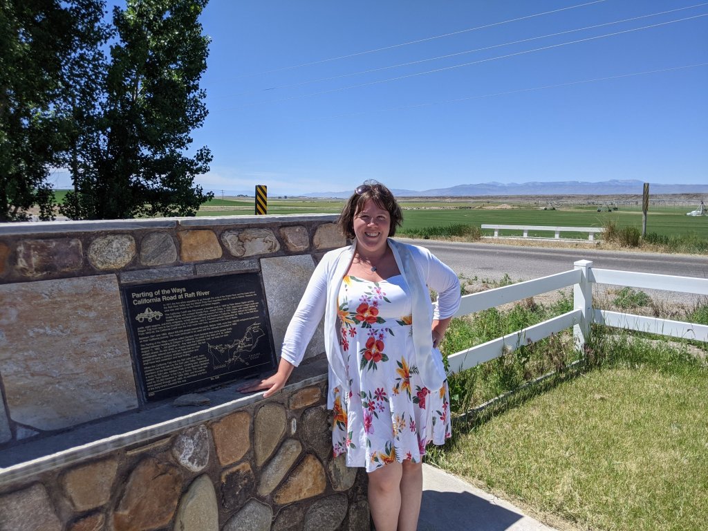
And here is where my fictional family breaks away from the Oregon Trail at the California Trail Junction/Raft River Crossing and heads southwest via the City of Rocks, and thence go we as well. “It is an area of fantastically weathered granite formations, which the emigrants fancied as steeples, hotels, houses, temples, and palaces in a ‘Silent City of Rocks.'” (National Park Service). Thanks to a random guide that I found right before we left for our trip, and Daniel’s expertise in reading maps, we were able to actually find the California Trail raft junction despite a lack of signs, which was pretty small and insignificant, but I was so excited to actually stand next to it.
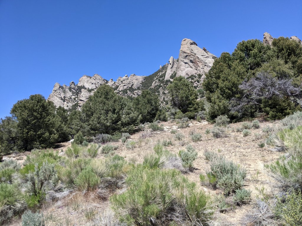
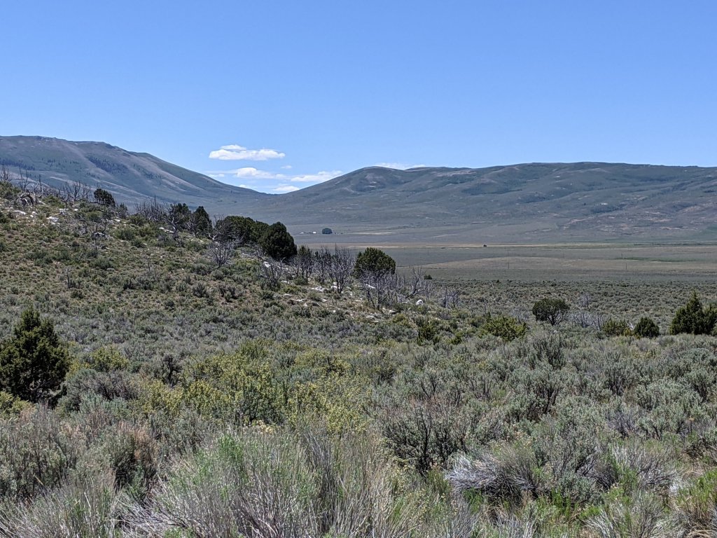
From there, we continued on to the city of rocks, and the higher we got, the larger the rock formations grew. At first I didn’t see what was so impressive about it, but when we went up a small dirt trail to an overlook, and it turned out to be a huge circle of rocky cliffsides, I was suitably impressed.
Now, I would like to take a moment here to complain and clarify. As you know, from all of my references to it, I have been closely following Julie Fanselow’s book Traveling the Oregon Trail. This book has been incredible in guiding me as I follow the Oregon Trail, offering tips, tricks, side treks, offering back road options, and providing the history to each and every stop. Here’s the issue. My fictional family goes to California, not Oregon, which means they break off into the California Trail. As I mentioned. But, while planning this trip, could I find a SINGLE BOOK OR RESOURCE following the California Trail? No. In fact, if you google the California Trail, you get a bunch of hiking trails in California (at least until google finally realizes that you are researching the Oregon trail and thereby infers that you might want different results). Thankfully, after digging through my Picture of the Past notes, I realized I had an actual California Trail map from my previous trip to Independence, MO. So, I traced the routes there, chose the route my family would most likely have taken, and planned the rest of the trip from there myself.
Considering many of the stops were barely noted on google, I was a little skeptical about how it would go, and held a secret hope that there would be signs along the way that said something like “Yes, the emigrants DID pass through here!”
Of course, after I went through all that work, after weeks of research, guess what I FINALLY stumbled across, once google deigned to give me applicable results for my searches? I discovered actual information from the National Park Service, as well as a guide from Emigrant Trails West on following the California Trail, complete with guided stops. This, of course, was only found after we had already booked all our stopping places for nights, which rather limits us. Thankfully, it appears I had mostly chosen the right way anyway, so We pretty much stuck with the original schedule as much as possible.
Granite Pass and Record Bluff were minor stops listed on the map; they appeared pretty out of the way, and according to the aforementioned guides, we’re on private property, but I held out hope of being able to see them, so from the City of Rocks we continued on through back roads in the middle of nowhere, stumbling across random markers every now and then which made me super happy. We found one marker that overlooked granite pass, and rather than continuing the half hour to what was probably private then anyway, I was perfectly happy with that. It was delightful to see, however, and once again I was unreasonably excited realizing that immigrants passed straight through there.
And from there, we continue on to find Record Bluffs. Again, the guide came in handy by saying it was on private property, so I figured if we didn’t see a marker for it we probably shouldn’t continue too much further. Also, I was a little bit worried about gas consumption and the fact that we were so far back in the boonies that we hadn’t seen a house in an hour, let alone a car. Once we reached the turnoff for Record Bluffs, we realized it would be an hour and a half to the location where Google said it was, and an hour and a half straight back to get back on the road actually on. So we decided to be content with taking a picture of the road, and saying we tried.

We were a little relieved when we finally got on the road back towards civilization, since it was a good two and a half hours to our campground, and as mentioned, we hadn’t seen a soul in ages.
Of course, and I were into that drive, the car popped up with a beep. Can anyone guess what for? Yup, a flat tire, and falling fast. We were a minimum of half an hour from any sort of gas station and probably a lot longer from paved roads. We kept going until we felt like it was not safe to go any longer, and pulled over to figure out what to do. At that precise moment, a man pulling a horse trailer passed us (no, we had only seen one other car in the last two hours) and offered to help. He had our spare tire on in 5 minutes flat, having an electronic impact wrench with him of all things. Utterly grateful, and certain that God had sent him just for us, we continued on for another hour and a half, pulled into the first town we had passed in four hours or so, looked ahead of us and saw a tire repair place. We pulled up, and the guy was able to patch our tire for $30. Immediately. We found out from someone else that they were one of the few places in town that wouldn’t overcharge you, and one of only two that were actually open on the weekend. Can anyone say God?

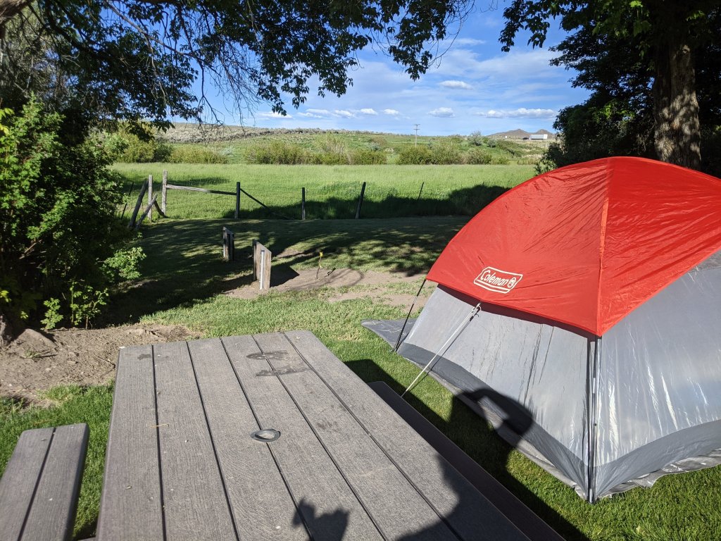
We continued on, reaching our campground significantly earlier than we originally thought we would, still on schedule, and it is a beautiful “Oasis in the desert “, as they say. The showers even look like normal showers, which means I get to wash my hair. And we bought ice cream and hamburgers from the campsite. We are pretty delighted right now.
Thank God for a fun day, filled with adventure, and unexpected blessings! Oh, and we even found a car wash to rinse off our incredibly dirty vehicle. We have so much more sympathy now for the wagon trains and the dust they had to deal with.

I see you are camping again. It sounds like you are having fun.
LikeLiked by 1 person
Lol, yes. Unfortunately, we can only do hotels and such every now and then.
LikeLiked by 1 person
@henhouselady, though my husband just told me we only have five more nights of camping on the trip! We have more other lodging since we are reaching CA.
LikeLiked by 1 person
I have to admit, you’re making me wish I could do a road trip like that!!! You guys look like you’re having an absolute blast!! And I’m loving your blog posts!! I’ve really enjoyed reading and following you along on your adventure!!!
LikeLiked by 1 person
Thank you! I’m so glad you are!
LikeLike
I would have been completely flipping out over that flat tire! What a great story tho.
LikeLiked by 1 person
Haha, yes, I was a little nervous. But God worked it all out!
LikeLike